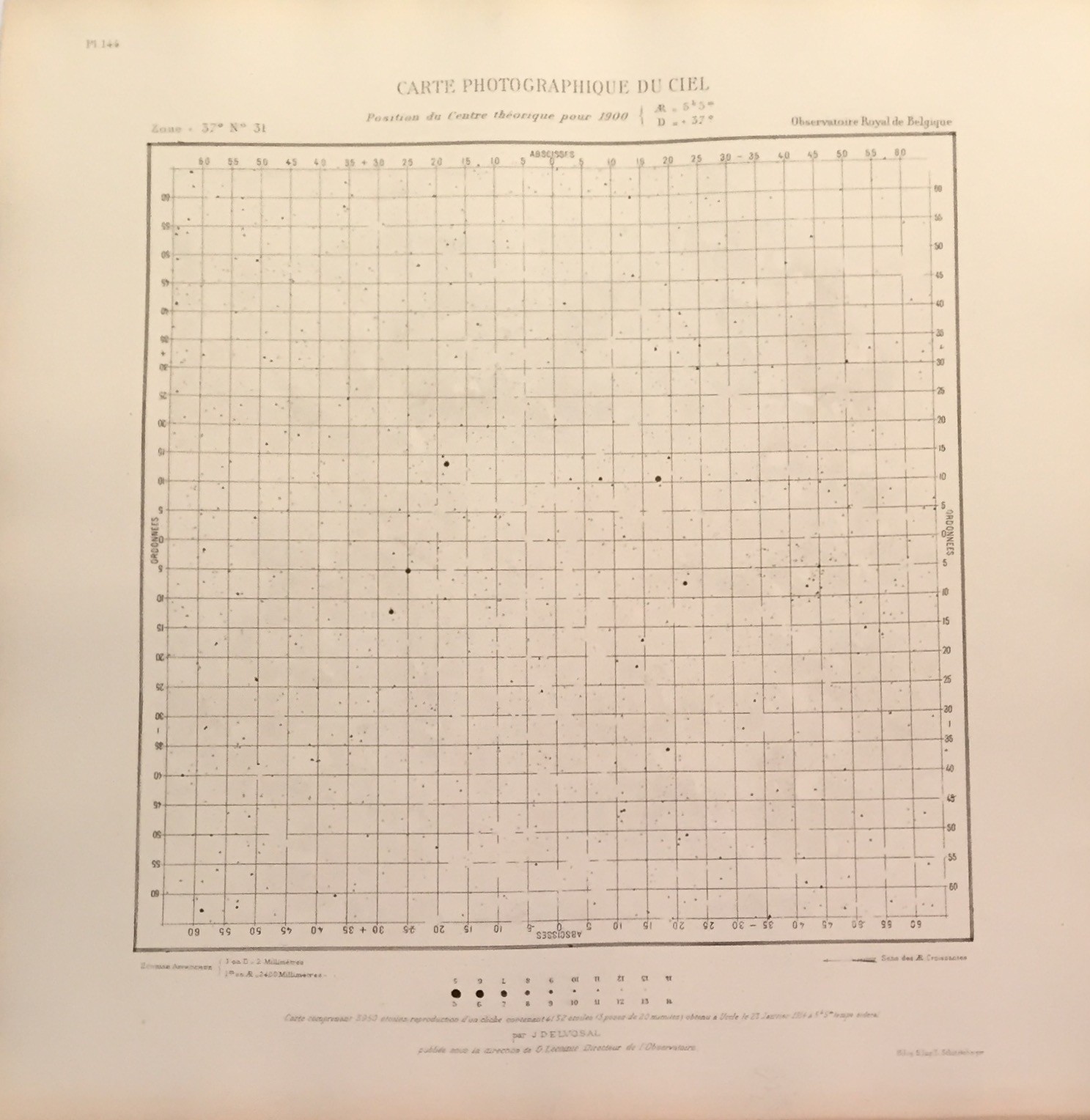
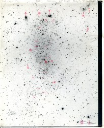
Photographic Map of the Sky, 1900, Observatoire Royal de Belgique, Planche n°144
Vintage
38 x 37,5 cm / 15 x 14,8 inch
Format : Square
Type : Black & White
Theme : Space
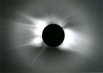
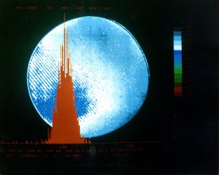
Total Solar Eclipse, 30 june 1973
Vintage gelatin silver print
18 x 25 cm / 7,1 x 9,9 inch
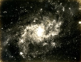
Triangulum Galaxy, August 1910, Mount Wilson Observatory, USA
Triangulum Galaxy (NGC598), Messier 33.
Vintage silver print
19,5 x 25 cm / 7,7 x 9,9 inch
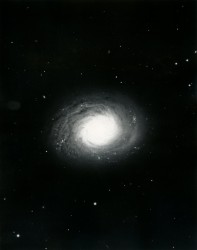
Anonymous photographer, Spiral Nebula in Canes Venatici, 1920
Spiral Nebula (Galaxy Messier 94 - NGC 4736) in Canes Venatici.
Vintage silver print
25 x 20,5 cm / 9,9 x 8,1 inch
Milky Way, c. 1950, Mount Wilson & Palomar Observatories, USA
Vintage silver print
35,5 x 35,5 cm / 14 x 14 inch
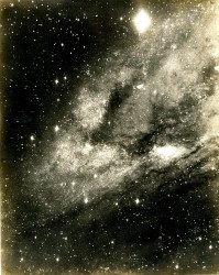
Sagittarius, 27 June 1919, Mount Wilson Observatory, USA
Vintage silver print
18,3 x 21,5 cm / 7,2 x 8,5 inch
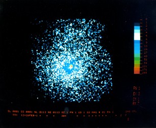
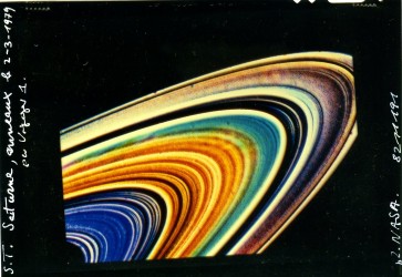
ESA ESTEC Supernova in Magellan, 1987
European Space Agency - European Space Research and Technology Centre
C-Print
20,2 x 25,4 cm / 8 x 10 inch
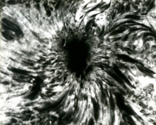
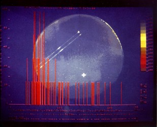
Solar Flare, c. 1970, Australia, CSIRO Solar Observatory Large sunspot.
Caption : “Large sunspot photographed in the wing of hydrogen alpha line. This shows the sunspot as it appears at the chromospheric as opposed to the photospheric level.”
Vintage gelatin silver print
19,7 X 25 cm / 7,8 x 9,9 inch
Spiral Nebula, c. 1910, Lick Observatory
Vintage gelatin silver print
25 x 21 cm / 9,9 x 8,3 inch
Nebula in Cygnus, c. 1950, Mount Wilson Observatory
Vintage Silver Print
34,5 x 27,7 cm / 13,6 x 10,9 inch
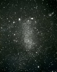
Barnard Galaxy (NGC 6822), 1910, Mount Wilson & Palomar Observatories
Gelatin Silver Print
25 x 21 cm / 9,9 x 8,3 inch
ESA ESTEC Seyfert Galaxy, 1987
European Space Agency - European Space Research and Technology Centre
C-Print
20,2 x 25,4 cm / 8 x 10 inch
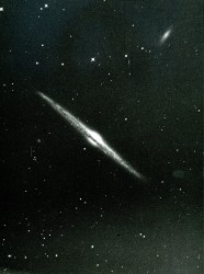
Needle Galaxy in Coma Berenice, c. 1910
Nebula - H.V.24 (NGC 4565), Coma Berenice
Vintage silver print
29 x 23 cm / 11,5 x 9,1 inch
Barnard Galaxy (NGC 6822), avec écriture manuscrite de Hubble, 10 juillet 1923
Gelatin Silver Print
25 x 20,5 cm / 9,9 x 8,1 inch
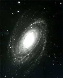
Spiral Galaxy, c. 1950, Mount Wilson & Palomar Observatories
Spiral Galaxy (NGC 5364) in the constellation Virgo
Vintage gelatin silver print
35,5 x 28,3 cm / 14 x 11,2 inch
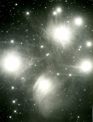
Marcel de KEROLYR, Around the Pleiades, Forcalquier, November 1932
Around Messier 45 (Pleiades), Taurus, the stars are (from lef to right) : Alcyone, Merope, Maïa, Electra.
Photograph presented in the book : Le poids du ciel (1938) written by Jean GIONO (Planche IX).
Gelatin Silver Print
12 x 15,5 cm / 4,8 x 6,2 inch

Andromeda Galaxy, c. 1950, Mount Wilson Observatory, USA
Messier 31 (M31 ; Messier 32 (M32)
Vintage silver print
27,7 x 33,5 cm / 10,9 x 13,2 inch
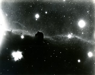
Orion MWO, 13 November 1920, Mount Wilson Observatory, USA
Horsehead Nebula (Barnard 33)
“Orion, IC 434, Nebula sout of Zeta Orionis containing Dark Bay (Barnard 33), exposure 3 hrs, 100 inch Hooker reflector”
Vintage silver print
19 x 24,5 cm / 7,5 x 9,7 inch
Marcel de KEROLYR, Observatoire de Forcalquier, Tadpoles Nebula (IC 410), 1933
Vintage silver print
16,5 x 22 cm / 6,5 x 8,7 inch
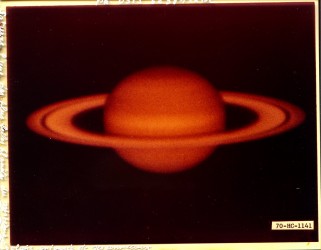
ESA ESTEC Hot Star, 1987
European Space Agency - European Space Research and Technology Centre
C-Print
20,2 x 25,4 cm / 8 x 10 inch
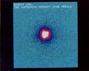
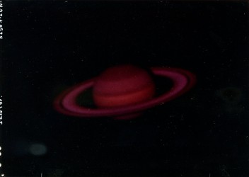
ESA ESTEC Supernova Remnant Crab Nebula, 1985
European Space Agency - European Space Research and Technology Centre
C-Print
20,2 x 25,4 cm / 8 x 10 inch
Andromeda Galaxy, 24 August 1925, Mount Wilson Observatory, USA
Andromeda Galaxy, south region, Messier 31 (NGC 224)
Traces of a former mounting in the back. Stamp of a Spanish edition. Original Mount Wilson Observatory label.
Vintage silver print
29 x 23 cm / 11,5 x 9,1 inch
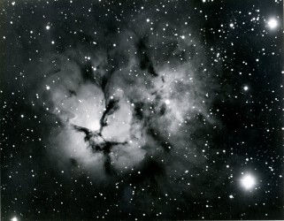
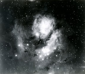
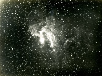
Trifid Nebula, c. 1920, Mount Wilson Observatory, USA
Trifid Nebula, Messier 20 (M20), in Sagittarius
Vintage silver print
18,7 x 23,7 cm / 7,4 x 9,4 inch
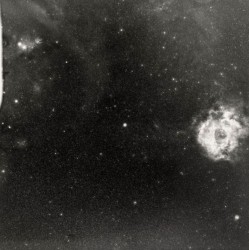
Milky Way and Rosette Nebula, c. 1950, Mount Wilson & Palomar Observatories, USA
Vintage silver print
35,5 x 35,5 cm / 14 x 14 inch
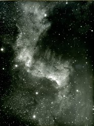
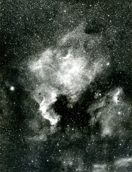
Cygnus Wall, North America Nebula in Cygus, 1910
North America Nebula (NGC 7000) in Cygnus.
Vintage silver print
22,6 x 16,7 cm / 8,9 x 6,6 inch
ESA ESTEC Young B Type Star, 1987
European Space Agency - European Space Research and Technology Centre
C-Print
20,2 x 25,4 cm / 8 x 10 inch
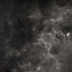
Anonymous photographer, North America Nebula in Cygus, c. 1920
North America Nebula (NGC 7000) in Cygnus
Vintage silver print
23 x 17 cm / 9,1 x 6,7 inch
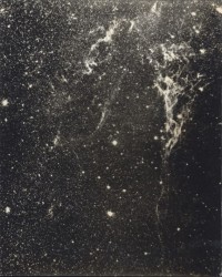
Milky Way, c. 1950, Mount Wilson & Palomar Observatories, USA
The Mily Way in Cygnus is rich of nebula. At the bottom of the photo you can see the Crecent Nebula.
The Dark Nebula discoverd by Barnard are prominent is this photo.
Vintage silver print
35,5 x 35,5 cm / 14 x 14 inch
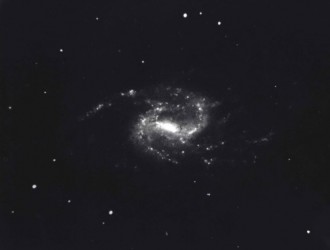
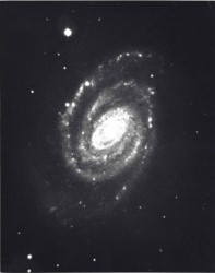
The Great Barred Spiral Galaxy, c. 1950, Mount Wilson & Palomar Observatories
The Great Barred Spiral Galaxy (NGC 1365) in the constellation Fornax.
Vintage gelatin silver print
35,5 x 28,3 cm / 14 x 11,2 inch
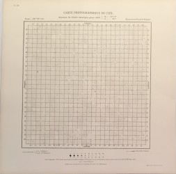
Photographic Map of the Sky, 1900, Observatoire Royal de Belgique, Planche n°118
Vintage
38 x 37,5 cm / 15 x 14,8 inch